At Altranft Castle - located on the western edge of the Oderbruch - our little journey begins along formative elements of the village of Altranft and its surroundings.
A journey from the history of the village to the history of the earth
Duration: 2 h, 5.8 km
Category: Footpath
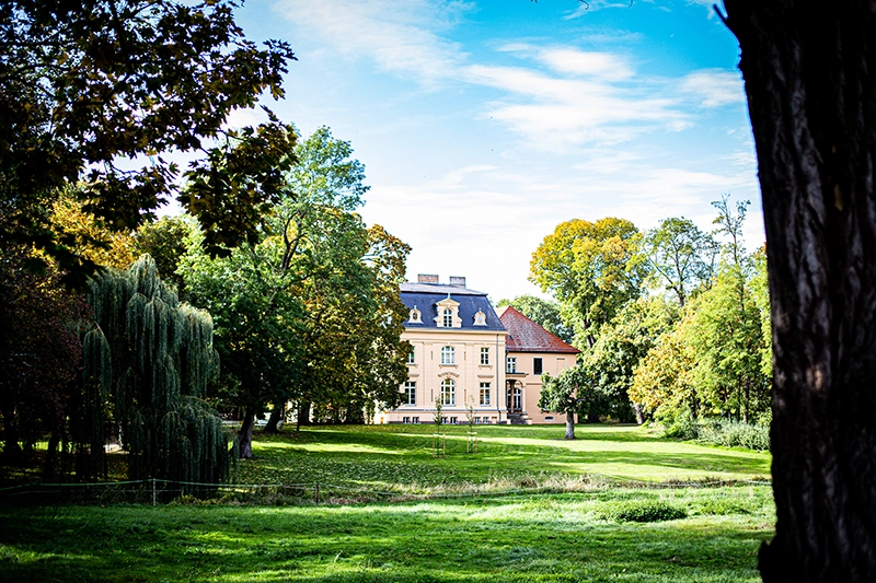
Between 1872 and 1876, Count Wilhelm Werner Georg von Hacke had the main features of the manor house rebuilt as they are today. While the building, commonly known in the village as the "castle", has been the residence of various landowners over the centuries, in the post-war period it served as a school, gymnasium and library, among other things. From 1990 onwards, extensive renovation work was carried out, during which the interior was redesigned in the Wilhelminian style. The castle is considered a representative testimony to the history of the Brandenburg nobility. The historical layers and conversions are particularly interesting, as many traces of architectural and cultural history can be found in them. Hans Ohnesorge, a committed cultural historian and conservationist living in the village, initiated the reconstruction of the park 12 years after the end of the war in 1957.
We continue towards the historic village center of Altranft with its characteristic cobblestone streets.
From the castle park, walk along Schneiderstraße (or optionally Schlossstraße) to Alte Heerstraße. On the left-hand side of Schneiderstraße is the old estate, which can be reached via a driveway. A wide variety of trades once gathered here, such as carpentry, blacksmithing, locksmithing and wheelwrighting. There was also a distillery where schnapps was distilled from potatoes. Animals were kept and agricultural produce stored in the stables and barns. Horse-drawn carts, machinery and agricultural equipment were also kept here. A wagon train ran through the east gate of the estate along the narrow lane to the beet fields down to the Bruchniederung.
Until the motorization of agriculture, village blacksmiths were indispensable and therefore enjoyed a high reputation. They made tools and farming implements, shod horses' hooves and repaired almost anything that was broken. There were a total of four blacksmiths in Altranft, one of them here in Schneiderstraße. It has been preserved and can be visited during the museum's opening hours. As the name suggests, Schneiderstraße was also home to other trades.
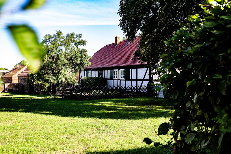
There are residential buildings in Schlossstraße. The farm workers who used to live here eked out a poor existence. Migrant workers and their families were also housed here seasonally in cramped conditions. For a long time, meals were prepared in black kitchens (rooms with an open flue). One such kitchen has been preserved in the thatched fisherman's house on the right-hand side of the street. Built in 1720, the half-timbered building is one of the oldest in the village and is said to have once been the Altranft fisherman's stand. Before the Oder was straightened and the anastomosing river landscape was embanked, fishing was one of the most important sources of income and trade. Agriculture could only be practiced on higher ground.
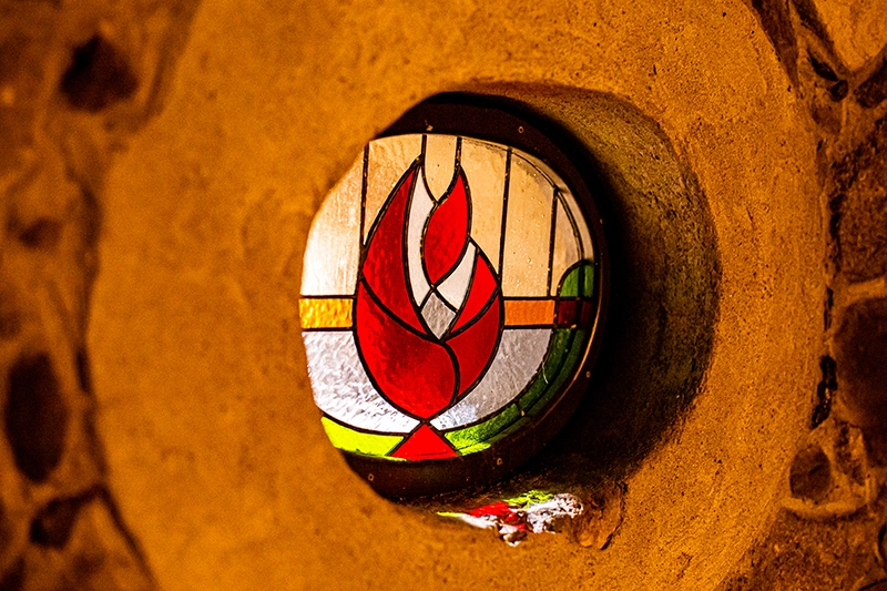
Photo: unknown-4-2
The Berg-Schmidt-Hof is located on the Alte Heerstraße, an old trade and transportation route, and takes its name from its slightly elevated location and the farmer and village schoolmaster Schmidt. The sprawling courtyard with its fieldstone barn and residential building suggests that he was one of the wealthier personalities in the village. After the loss of their original farm in the village fire of 1829, the family was able to build a new, prosperous farm here and later extended it with a large brick barn. These free farmers lived in the immediate vicinity of the less prestigious migrant workers, cottagers and harvesters (the so-called reapers). In the 19th century, stores, bakeries and grocery stores settled on Alte Heerstrasse, as well as housing for the mine workers who were brought in to mine lignite.
Continuing on our way, we walk along Alte Heerstraße towards Bad Freienwalde until we reach the nearby crossroads and the Breitengrad discotheque on the left. On the left behind this former inn, which - like the manor house - was first mentioned in 1375 and had names such as "Der Krug" and "Zum Goldenen Hufeisen", was once again a smithy. Due to its special location, Altranft was a lively village characterized by a variety of daily activities.
Photo: unknown-27
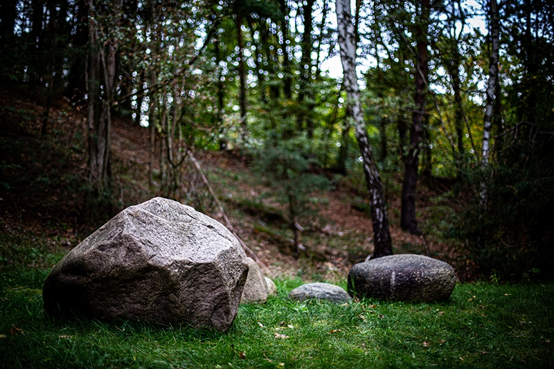
A completely different dimension is revealed by the geological observation that now presents itself. To do this, we turn into Sonnenburger Weg and turn right after the underpass to the geological nature trail. The Weichselian glaciation ended around 11,600 years ago - the last glaciation in which an ice sheet advanced from Scandinavia to northern Central Europe. Prior to this, over a period of up to 400,000 years, glaciers picked up all kinds of sediments and rocks of various sizes in the Scandinavian-Finnish region and transported them to north-central Europe. In the middle of the 20th century, the rocks exhibited on the nature trail were uncovered in the local gravel pit and exhibited in 1964 by Hans Ohnesorge with the help of a group of schoolchildren from Altranft in Brandenburg's first geological nature trail. The stones are mainly crystalline boulders - some of which are over a billion years old - and are still scientifically significant today. The main boulders (granites, gneisses and basalts mainly from central and central Sweden and eastern Scandinavia, porphyries and others from the Baltic Sea basin as well as calcareous material) are also found at other outcrops in north-eastern Brandenburg. Based on their scattering patterns, the alternating direction of movement of the ice could be traced. However, precise rock and origin determination requires a great deal of expertise and experience. Especially in crystalline rocks, there are many similar formations that need to be distinguished. In this case, Alfred Müldner from Berlin carried out the first petrographic investigation. Often, however, the origin can only be guessed at.
In the former expansion area of the glaciers in northern Germany, many of these stones can be found in various buildings, such as churches and fortifications. In Altranft, too, boulders were used alongside building materials such as wood and clay to build houses.
The "Altranft Geological Nature Trail" natural monument is now recognized as a protected landscape feature. It is not only interesting from a geological and geomorphological point of view, but is also home to a rich variety of flora and fauna. With 37 breeding bird species and 21 woodland species, this habitat stands out from the surrounding pine forest.
List of rocks on the Geological Nature Trail according to Alfred Müldner (from "Guide to the Geology of Berlin and Brandenburg" and "The Altranft Geological Nature Trail")
- Åland-Rapakiwi granite / Åland Islands
- Gneiss granite / Southern Sweden
- Gneiss granite with feldspar accumulations / widespread in Scandinavia
- Granite with polished surfaces / probably Sweden
- Åland-Rapakiwi granite with distinct ovoids (ovoid inclusions), boulder / Åland Islands
- Fine-grained granite with pegmatite streaks, widespread in Scandinavia
- Fine-grained diorite magmatic deep rock / Southern Sweden
- Åland-Rapakiwi granite boulders/ Åland Islands
- Gneiss granite / widespread in Scandinavia
- Hornblende gneiss with quartz vein / probably central and southern Sweden
- Gneiss with pegmatite vein / widespread in Scandinavia
- Anatexitic granite with xenoliths / Central Sweden
- Coarse-grained granite with glacial polish / Scandinavia
- Åland granite boulders / Åland Islands
- Coarse-grained anatexitic diorite inetamorphically overprinted / Sweden
- Scolithic sandstone quartzitic sandstone / southern Sweden or Bornholm
- Kinne-Diabas / southern Sweden, south of Lake Vänern
- Hornblende gneiss with mixed veins and traces of polishing / Sweden
- Granite with garnet and twin-striped plagioclase / Sweden
- Pegmatitic granite / Sweden
- Öje-Diabas volcanic igneous rock with calcite almonds / Dalarna, central Sweden
- Porphyritic granite, Arnö type, boulder / Central Sweden
- Åland - Quartz porphyry boulders / Åland Islands
- Tand-Rapakiwi granite with distinct ovoids, conductive boulders/ Åland Islands
- Dark granite with xenolith / probably Sweden
- Gneiss with biotite enrichments / Sweden
- Gneiss granite folded, fine-grained / probably Sweden
- Dala quartzite fine-grained reddish quartzitic sandstone / Dalarne, central Sweden or Baltic Sea area
- Järeda granite coarse-grained porphyritic ocular granite, boulder / Småland
- Dala quartzite fine-grained reddish quartzitic sandstone / Dalarna, central Sweden or Baltic Sea area
- Biotite-rich gneiss with diabase vein and quartz-filled and mutually displaced fissures / Scandinavia
- Småland granite with blue quartz / Småland, southern Sweden
- Contact phenomena between crushed red-grey and solid granite / Southern Sweden
- Coarse-grained Rapakiwi granite porphyry Guiding boulders / Southwest Finland
- Pegmatite granite with large orthoclase crystals / Deposit not known in detail
- Tertiary lignite, silt and mica sand of Miocene age
- Tertiary sandstone
- Hornblende gneiss with granitic inclusions / Scandinavia
- Red Växjö granite / Småland, southern Sweden
- Åland aplite granite / Åland Islands
- Åland granite / Åland Islands
- Uppsala granite / Central Sweden
Some terms explained:
Basalt - dark, dense, fresh, basic effusive rock consisting mainly of plagioclase and pyroxene, which may also contain olivine and iron ore. The basalts rose during the Mesozoic and Neolithic periods.
Diabase - fine- to medium-grained basic effusive rock with the same petrographic composition as basalt. In contrast to basalt, diabase was formed in the early and Palaeozoic era. As a result of ageing and weathering, the diabase often has a slightly greenish tint.
Gneiss - metamorphic rock with a parallel texture, consists of quartz, feldspar, mica and some minor constituents
Almonds - bubble-shaped cavities in effusive rocks, which were secondarily filled mainly with klacite and quartz
Calcite - calcite, a rock-forming mineral, often occurs in beautiful crystals
Minerals - all mostly solid, in the physical and chemical sense homogeneous, almost exclusively inorganic natural bodies of the earth
Ovoids - ovoid crystals, mostly orthoclase in Rapakiwi granites
Pegmatite - an alternating-grained, generally coarse-grained vein rock that often contains beautiful crystals
Rapakiwi - (Finnish: rotting stone), coarse-grained to porphyritic granite with characteristic porphyroblasts or ovoids of orthoclase surrounded by a thin shell of plagioclase. As the plagioclase weathers faster than the orthoclase, the ovoids fall out of the surface of the rock.
Porphyroblasts - large new crystal formation, with crystal surface, eye-shaped rounded, in dense or fine-grained groundmass
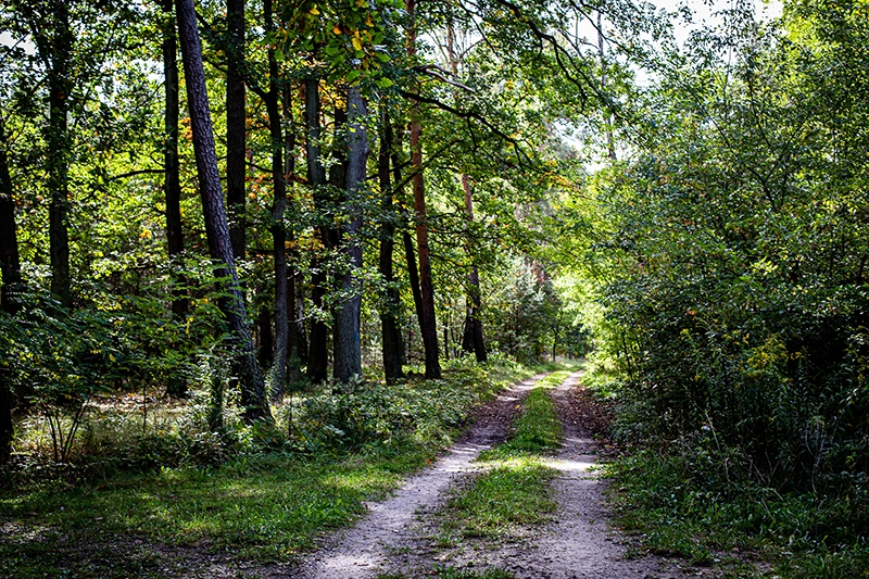
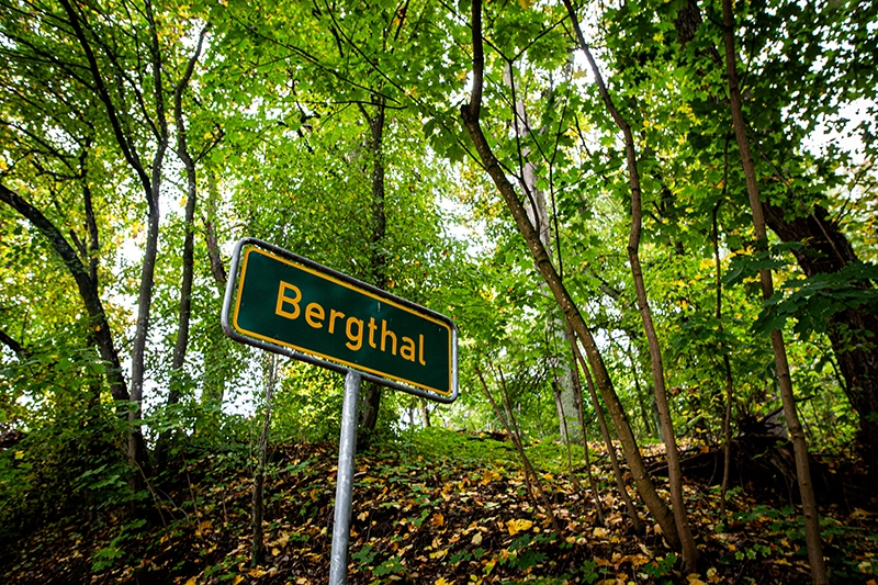
To continue the trail, we head southwest along the edge of the nature trail near the tracks onto the forest path and walk parallel to the housing estate and Sonnenburger Weg for approx. 700 m. At the junction of the tracked path, we turn left towards Sonnenburger Weg and follow it to Bergthal.
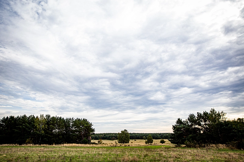
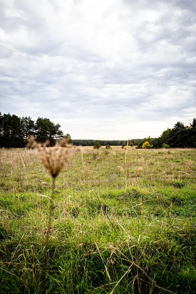
Over the course of several thousand years, the ice expanded and retreated in alternating colder and warmer phases. However, the ice was unable to overcome the edge of the Barnim upslope, which caused formative compressions and disturbances of the loose rock. This gave rise to the terminal moraine landscape typical of the glacial margin zone. In addition, these movements also transported local debris such as lignite and (turf) iron ore close to the earth's surface. The hollow shape of the Oderbruch already existed before the last ice advances. During the Pomeranian phase, the depression was filled with ice. The Thorn-Eberswalde glacial valley formed locally above this ice layer. The subsequently retreating glacier released the Oderbruch again and also left behind a heterogeneous drainage landscape, which is clearly visible in the periglacial area from Bad Freienwalde to Seelow, flowing into several alluvial fans. In this area, the sandy silty material was responsible for the formation of the dry valleys. So-called soil flow, in which permafrost soils alternately thawed and froze again, caused mass movements in the slopes and also created the Altranft dry valley, for example. The characteristic terrace-like transitional area at the edge of the Middle Oderbruch here near Altranft can be traced back to meltwater at different runoff levels from the glacially elevated glacial valley on the one hand and to the floodplain dynamics of the Holocene river landscape of the Oderbruch on the other. Different water levels transported fluviatile sediments and left behind alluvial soils in the lowlands, predominantly with loam and clay components as well as overlaying and mixing with Pleistocene valley sands. Recurrent flooding of the post-glacial landscape was a formative force until the regulation of the Oder and its tributaries around 250 years ago.
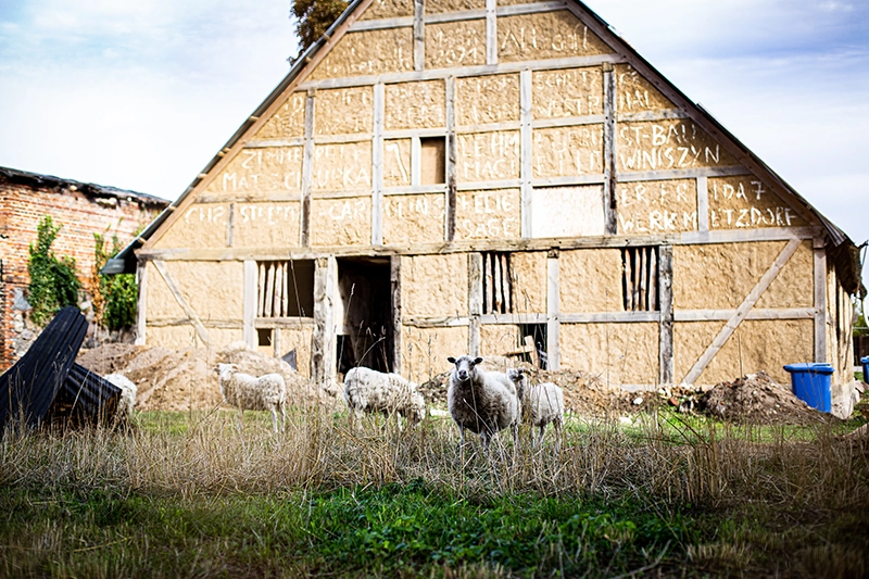
The Bergthal estate was home to a sheep farm where, from the period after the Thirty Years' War (from 1675 to 1945), up to 2,500 sheep were kept at times, mainly for wool production. At that time, shepherding was a profitable business in Germany, but in the mid-19th century it experienced a sharp downturn due to competition from Australia and the associated fall in the price of wool. After the Second World War, the Soviet army maintained a military training area here, but it continued to be used as a sheep pasture.
After a bend to the right, we continue along the path and then keep left again on a long straight that takes us close to the station.
Due to its agricultural productivity, the Oderbruch became an important supplier for the city of Berlin. The construction of a railroad line from Wriezen to Eberswalde began as early as 1866 in order to create a connection to the Berlin-Stettin railroad network. Altranft also experienced an economic boom in the middle of the 19th century and produced a high volume of goods. However, a station was not established here until 1880 on the initiative of Count Edwin von Hacke. A lignite mine was also operated near the station from 1838 to 1904, producing up to 55,000 tons of coal annually. The coal was processed in a neighboring briquette factory. Today, only pictures and the simple miners' houses on Alte Heerstraße bear witness to the lignite industry. The transportation of goods by rail came to a standstill at the end of the 20th century. Today, there is only one passenger train per hour in each direction.
Back on Alte Heerstraße, we follow it briefly to the left before turning right into Von-Hacke-Straße. Over the centuries, Altranft has been dominated by changing landowning families who have had a major influence on village life. In 1536, Melchior von Pfuel is mentioned as the first landlord of Altranft. The aristocratic rule of the von Hackes, who made decisions for the village over three generations, lasted 97 years. This was followed by the comparatively short but very productive period of the bourgeois Eschenbachs.
Halfway down Von-Hacke-Straße, on the right-hand side (on Rotdornweg), is the "Neue Schule". The large white building was completed in 1926 after a long 36-year lead time and planning. At the time, it was considered the most beautiful and modern school building in the district of Oberbarnim with its good facilities and interesting façade design. In the previous centuries, conditions for schoolchildren had improved only slowly. After working in the fields or in the household, they were often only taught by craftsmen or former soldiers in residential buildings. In 1715, the sexton's house near the church was used as a school building, which was repeatedly renovated in the 19th century, but still only offered small rooms. It was not until the influx of new settlers at the beginning of the 20th century and the subsequent increase in the number of children that a new school was built, which was used until 1999.
We walk to the end of Von-Hacke-Straße and turn left towards the cemetery and church. At the cemetery, you can see an old wall that was built to mark the boundary to the estate. It was made from a sand-lime-gravel mixture using the so-called mortar tamping method - a rarity today.
Now we can turn right into the small alley and directly to the Anger and then (right again) in a south-easterly direction to the Mittelflurhaus (am Anger 20). It is the oldest residential stable house in the Mark Brandenburg, in which the inhabitants lived together with their animals under one roof; its construction dates back to 1698. In the 17th and 18th centuries, this was a characteristic type of building of the half-farmers (Kossäten - therefore also called Kossätenhaus) in many Oderbruch villages. Equipped with little land, the cottagers led a modest life, but pursued a variety of activities to ensure their survival. Several of these houses stood close together here until the aforementioned village fire. The decision not to rebuild the middle row of the Angers after the village fire explains the expansion of the settlement along Schneiderstraße and Heerstraße.
A fire station dating from 1862 is located on the green behind the church. Fire-fighting equipment was stored in such buildings, and the fire stations were also used as places of detention for arrested persons.
The patronage church is probably the third church building on this site. The respective landowner was the church patron and administrator. The riveted wooden door at the entrance dates from the year of construction (1752). The church tower was rebuilt in 1901 and Carl Eschenbach donated a tower clock in 1926. During the First World War, two of the three bells were removed for use in war production. In the interior of the church, the Ascension of Christ is depicted in a ceiling painting from 1906.
In the direction of the castle, we turn right before the castle park into a lane that leads us over the turnip train bridge onto the flood protection dam. The crops were transported along here from the fields to the estate by the aforementioned wagon train. The fertile, loamy soil was particularly suitable for the large-scale cultivation of sugar beet. With the introduction of this crop in 1832, the sugar industry became one of the most important economic sectors in the Oderbruch. Altranft also had its own sugar factory until 1915, which can be seen from this spot when looking out into the Oderbruch. The light railroad with its ox-drawn wagons connected the factory with both the estate and a landing stage on the Alte Oder. The sugar industry and agriculture in general contributed significantly to the development of the Oderbruch and a period of prosperity that only lasted into the 20th century. Today, although sugar beet is a valuable catch crop, it is less common in the Oderbruch soils.
To this day, agriculture dominates the landscape in Germany's largest populated river polder. The control of water with pumping stations, dykes and polders, dams and weirs and drainage ditches - a huge, complex landscape machine - is crucial for stable agricultural use.
Our tour ends with a view back to the castle. We view it from here through one of the three lines of sight. Even when the castle park was planned in the 19th century, the lord of the manor wanted to showcase the castle in this way.
developed by Benjamin Huster
with the assistance of Dr. Gerd Lutze, Prof. Dr. Wilfried Hierold and Dr. Kenneth Anders